Step 1 - Mapping
Objective: To generate comprehensive information about the springshed – including web-based maps, GPS locations of springs, and basic socio-economic information.
Main Activities
Regional mapping of springs using LIDAR-based sensor technology and ground -
truthing.
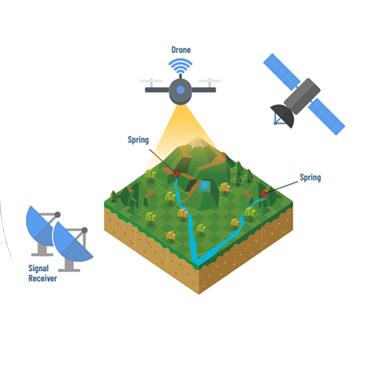
Developing spring potential maps by combining LIDAR data with other RS-GIS
sources.

Technology capacity building of VLIs like the Gram Panchayat, WUGs on data
collection.

Geo-tagging and documentation of land - use, ownership, and demographic information on
springs.

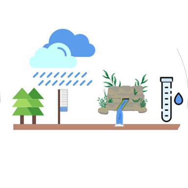
Systematic data monitoring of rainfall, spring discharge, and water quality.
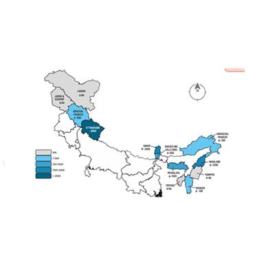
Total spring inventories using a standard format across the IHR ~15000.